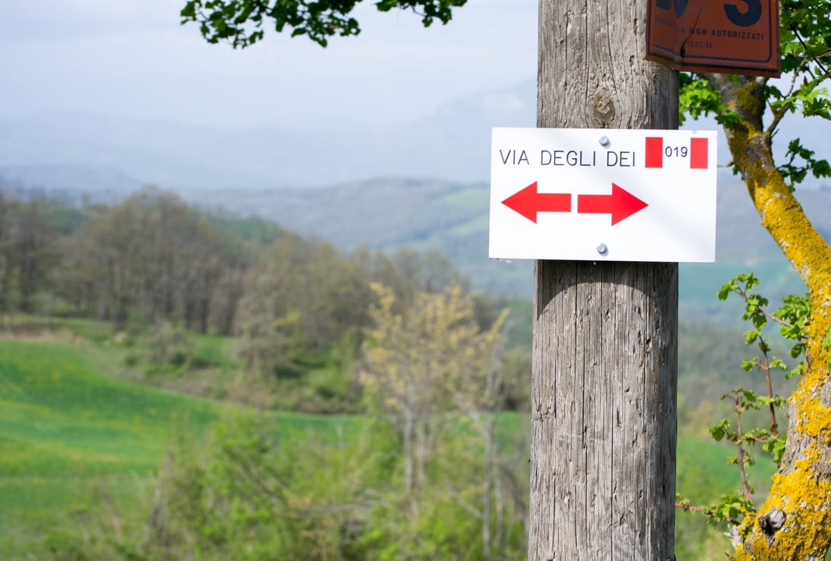
The Via degli Dei is a suggestive route that connects the city of Florence and that of Bologna crossing the Apennines. The history of the Via degli Dei dates back to the Etruscans: for at least 4 centuries, in fact, this population traveled an ancient path that connected Fiesole with Felsina , to develop their commercial traffic. However, it was the Romans who built a real trans-Apennine Roman road on this route called the Flaminia Militare.
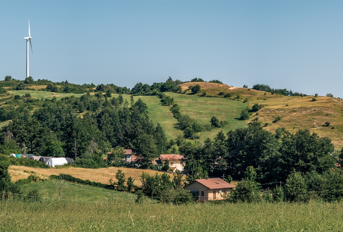
The real Via degli Dei was created in the late 1980s by a group of hikers from Bologna , following the ancient routes. Today the Via degli Dei , which owes its name to the fact that it crosses places such as Monte Adone, Monzuno, Monte Venere and Monte Luario , has become a major tourist attraction in the Apennines, especially for lovers of trekking and mountain biking . To complete all the stages of the Via degli Dei it takes about four-six days on foot and two-three days by bicycle . It is obviously not necessary to complete the whole journey, you can also do just a few sections: for this reason the Via degli Dei is an ideal route for all types of walkers, to be tried at least once in a lifetime.
1. Via degli Dei, the first stage: from Bologna to Badolo
The first stage of the Via degli Dei starts from Piazza Maggiore in Bologna . Continuing towards via Saragozza, after passing through the Meloncello arch, you will have to walk along the longest portico in the world, the one that leads to the Sanctuary of the Blessed Virgin of San Luca . Once in San Luca go back down towards Casalecchio di Reno, to then take Via de' Brègoli which will take you to the Talon Park passing through a wooded forest. It runs along the banks of the Reno river to continue in the direction of Sasso Marconi and reach the Naturalistic Oasis of San Gherardo . The route continues up to the Sasso/Pontecchio crossroads, where you will have to take the road for Sasso. You will arrive at the Sasso Marconi station , to go up the CAI path 122, which leads to the Prati di Mugnano park . Pass inside the park, pass the car park and arrive at the square, continuing along the CAI 122 path which turns left. Once in via delle Orchidee, turn right onto the Badolo provincial road until you finally arrive in the village.
The first stage is about 22 km : on foot it takes almost 7 hours to complete the route, while by bicycle it takes just 2 hours and 30 minutes .
What to see between Bologna and Badolo
The first stage of the Via degli Dei Bologna Florence offers some wonderful beauties , including:
· Piazza Maggiore , with some of the symbols of the city of Bologna including the Neptune, the Basilica of San Petronio, the Palazzo del Podestà, Palazzo Re Enzo and Palazzo d'Accursio.
· The Portico di San Luca , with its 666 arches and a length of about 3.8 kilometres.
· The Casalecchio lock , the oldest masonry hydraulic work in Europe and still in operation today.
· The Oasis of San Gherardo , a place of protection and conservation of the local fauna and flora where you can practice birdwatching, trekking and Nordic walking. If you are with children, you can also stop at the "Casa della Natura", a documentation center to learn more about some native plant and animal species.
· The Nova Arbora Botanical Garden , a suggestive oasis of peace with fruits, flowers and plants and where a very particular poison garden is located.
· The Colombarium of Monte del Frate , a deep cavity with two large openings to the outside and many small niches dug by man whose function is still uncertain today.
2. Via degli Dei, the second stage: from Badolo to Madonna dei Fornelli
The second stage of the route of the Via degli Dei starts again from Badolo . From here, continuing along the path, you will reach Brento and then you will skirt the Center for the Protection and Research of Exotic and Wild Fauna of Monte Adone . Following on the left you will find the CAI 110 path that will take you to Monte Adone , from which you can enjoy a wonderful panorama. Go down again towards Brento and, taking the stretch of paved road, arrive at Monzuno . From Piazza XXIV Maggio continue in the direction of Madonna dei Fornelli, pass the crossroads for Loiano and take an uphill road. Reach the locality of "Campagne" and take the CAI route 19. After crossing the chestnut wood you will reach the houses of Le Croci. Make a short climb up to Monte del Galletto and then take a dirt road to get to Madonna dei Fornelli , about 3 hours away from Monzuno.
The second stage is about 28 km : on foot it takes almost 10 hours to complete the route, while by bicycle it takes just 2 hours and 30 minutes .
What to see between Badolo and Madonna dei Fornelli
In the second stage of the Via degli Dei you can dedicate yourself to visiting:
· The Center for the Protection and Research of Exotic and Wild Fauna of Monte Adone , which houses animal specimens of all species, from the local fauna of the Apennines to tigers, lions and chimpanzees.
· The Pliocene Buttress , characterized by the presence of fossils and shells which demonstrate that there was a sea in these places during the Pliocene era.
· The chestnut trees of the Monzuno woods, centuries-old trees considered the symbol of the Apennines and also called "bread trees" because a flour used for various preparations is obtained from their fruit.
· Borgo Le Croci in Monzuno, where there is a large flat area from which the bravest can go hang-gliding.
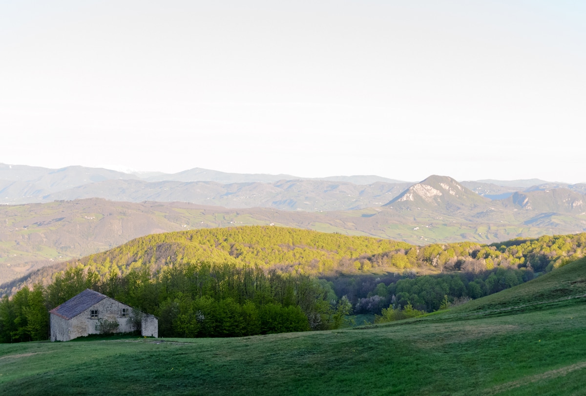
3. Via degli Dei, the third stage: from Madonna dei Fornelli to Monte di Fò
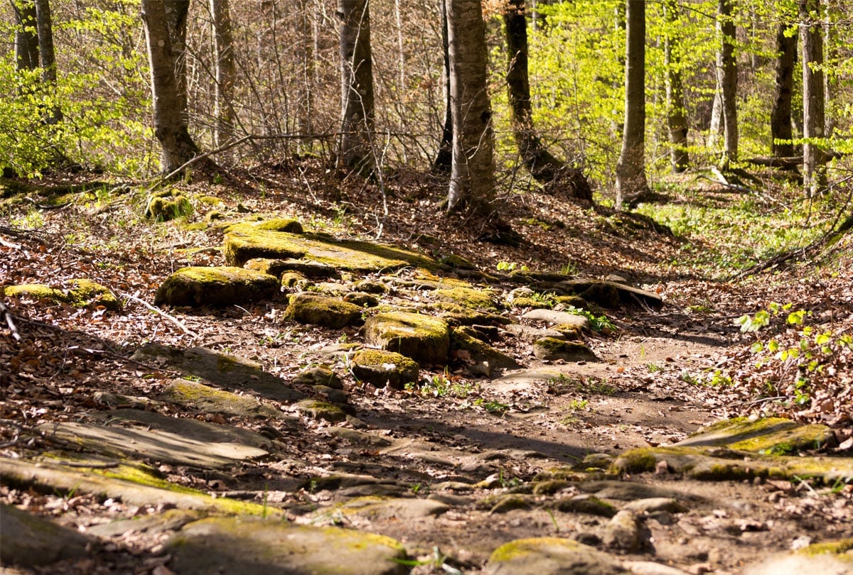
The stages of the Via degli Dei continue: from Madonna dei Fornelli continue towards Pian di Balestra, along the CAI path 19. Follow the signs for Via degli Dei – Futa and Strada Romana and pass a small gate to enter a wood. After a few steps you will be able to admire sections of the Flaminia Militare , the ancient Roman route. You come to a second gate, after which there is a large field with a stone house in the locality of "I Capannoni". Continue along the dirt road and then follow the directions for the route, until you reach a crossroads where you turn right.
Continue on the CAI 19 path up to Piana degli Ossi , where you can admire the remains of a furnace from the 2nd century BC.
Continue towards Il Passeggere and turn left at the crossroads. Go ahead until the next crossroads, where you will have to turn right and you will come across an artificial lake to skirt along. The path goes uphill to the left, until it comes out of the wood to meet two plains, one of which is the Banditacce clearing .
Reach the top of the Banditacce – at 1200 meters – and, after a few meters, you will reach Poggiaccio , which represents about half of the Via degli Dei . Going down to the left you can see other finds of the ancient Roman road. Continue the path up to the slopes of Poggio Castellucci, arriving at a coniferous forest. Go ahead following the signs for Futa up to a paved road that leads from Pian del voglio to Passo della Futa, the SS 65. At the roundabout, take the right and after a few meters you will find the sign for Santa Lucia – Monte di Fo': take the path to the left and continue for another 3 km, until you reach the crossroads where, turning left, you will arrive in Monte di Fo' .
The third stage is about 18 km : on foot it takes almost 6 hours to complete the route, while by bicycle it takes just 2 hours .
What to see between Madonna dei Fornelli and Monte di Fò
The third stage of the Via degli Dei trekking route offers you beauties such as:
· Madonna dei Fornelli , a typical Apennine village that offers tourists and wayfarers a suggestive experience of slow tourism, in a protected, genuine and typically Emilian environment.
· The signs of pietra serena , a gray sandstone used by the Etruscans and Romans and typical of Tuscan architecture, especially in the Firenzuola area.
· The Flaminia Militare , the ancient road of about 24 km built by the Roman legions according to the typical characteristics of an official road. Think that for every meter of this path, about 25 quintals of sandstone have been used.
· The Gothic Line , of which 5 km remain visible near the town of Santa Lucia, in particular you can admire the anti-tank ditch, two cannon bunkers, two underground and two completely exposed.
· The Futa German cemetery , the largest of the 12 German military cemeteries in Italy, a perennial reminder of a war that severely hit the Apennine area.
4. Via degli Dei, the fourth stage: from Monte di Fò to San Piero a Sieve
Starting again from Monte di Fò, take the road that leads to Apparita. Continue on the paved road until you enter a forest. Continue following the GEA directions and, when you reach the crossroads, take the CAI 00 path, which leads to Monte Gazzaro . Once you reach the summit, continue along the ridge and descend, always going straight and finally reaching a large clearing, the Passo dell'Osteria Bruciata . An inn known for dishes made with human flesh was once located here, as the owner robbed and murdered his guests. Continue along the path to Sant'Agata, the CAI 46, until you reach Riarsiccio . Go ahead and, when you reach the crossroads, continue towards San Piero a Sieve . The road that will take you to this locality is partly unpaved, parallel to the state road in the direction of Gabbiano.
The fourth stage is about 22 km : on foot it takes 6 and a half hours to complete the route, while by bicycle it takes just 2 hours.
What to see between Monte di Fò and San Piero a Sieve
The path of the Via degli Dei reserves in the fourth stage other beauties to be discovered:
· The white cross of Monte Gazzaro , next to which there is a small stone structure that contains the "summit book of Monte Gazzaro", where you can write your thoughts and your emotions.
· The Museum of Sant'Agata , formed by a permanent exhibition of characters in movement who once really lived there.
· The Castle of Montaccianico , which was not only a control post but also a hiding place for political exiles such as Dante, who found shelter there in 1302.
· The Medici Fortress of San Martino , commissioned by Cosimo I with the aim of defending Florence also given its strategic position, on a hill that descends to the Sieve.
· The Bosco ai Frati Convent , founded by the Ubaldini and today the seat, in one of its rooms, of a small museum of sacred art where there is also a wooden crucifix by Donatello.
· The bridge over the Sieve river , which once connected Florence to Romagna and the Casentino to the Valdarno and which was destroyed (and then rebuilt) several times both by the floods of the river and by bombing during the war.
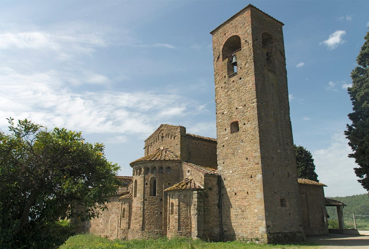
· The Romanesque parish church , a typical Romanesque building from the 11th and 12th centuries, one of the oldest in the Mugello.
5. Via degli Dei, the fifth stage: from San Piero a Sieve to Florence
The last stretch of the Via degli Dei starts right from the historic center of San Piero a Sieve , following the paved road with signs for the Medici Fortress . Take the dirt road on the right and keep walking following the CAI Bo-Fi signs. Continuing you will come to a paved road, and once you turn right, take a dirt road that indicates "Trebbio, Cadenzano".
Continue on the path and at the big crossroads that you find in front of you, take the road on the left, uphill. The road climbs slightly but offers you a spectacular panorama, made up of an expanse of olive trees . You will thus arrive in Trebbio : continue following the CAI 17 Bo-Fi Bivigliano signs. Also on this road you will be able to enjoy a wonderful view of the Mugello, among olive trees, villages and shrines.
Continue towards Tagliaferro , staying on the CAI route for Bivigliano. After taking the dirt road, turn left and leave the dirt road to continue through the woods. The path climbs until it reaches a crossroads, where you have to continue taking the CAI 00 road. You will reach a small clearing called " Camporomano ": the path turns right again into the woods.
Once you arrive on the paved road, you will find the Badia del Buonsollazzo on the right , continue until you reach the sign for the Convent of Monte Senario . Take the road that runs alongside the convent on the right and go down the tree-lined avenue. The path continues in the woods and then reaches an asphalted road. Continue on the road until the path resumes at Vetta le Croci. This last stretch will lead you to Olmo : along the way you will be able to admire both Fiesole and Florence in the distance. The path ends once again on a paved road which, once crossed, will lead you to the CAI path 2 which continues uphill towards Poggio Pratone . From here go down to Monte Fanna , cross the hamlet of Borgunto and finally arrive in the square of Fiesole . Then take the panoramic road up to the middle schools and follow the CAI 7 path that goes up to Monte Ceceri , passing by the quarries of Maiano , and up towards Settignano and finally allows you to reach Florence via Coverciano.
The fifth stage is about 33 km : on foot it takes more than 11 hours to complete the route, while by bicycle it takes just 3 hours .
What to see between San Piero a Sieve and Florence
Also in the final stage of the Via degli Dei route you can make several stops to admire natural and architectural beauties such as:
· Trebbio Castle , feudal manor of Cosimo de' Medici and much loved place by famous historical figures such as Lorenzo the Magnificent, Giovanni delle Bande Nere and Amerigo Vespucci.
· The Badia del Buonsollazzo , an ancient Benedictine abbey from around the 12th century whose name probably derives from the Latin "bono solatio", meaning sunny place, due to its fortunate location on the side of Monte Senario which is always exposed to the sun.
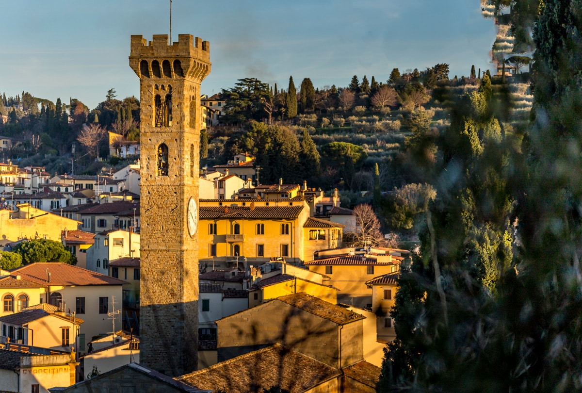
· The Etruscan city of Fiesole , with a large archaeological area which houses the Roman theatre, the Cathedral of San Romolo and the Convent of San Francesco in its historic centre. In Fiesole you can also visit the Vie Cave, famous for its sandstone.
· The Piazza del Duomo in Florence , where you can be amazed by the majesty of the buildings surrounding the square, such as the Cathedral of Santa Maria del Fiore, Giotto's bell tower, the Museo dell'Opera del Duomo and the Baptistery of San Giovanni.
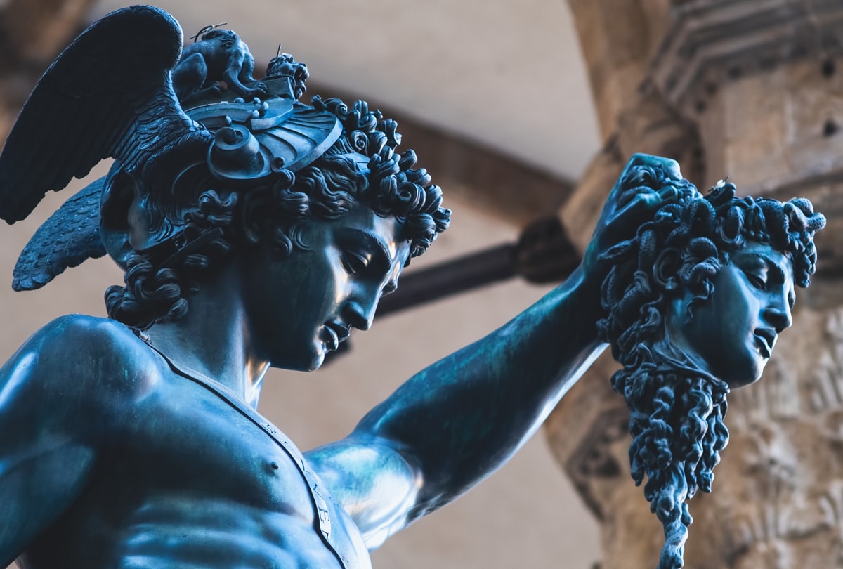
· The statue of Perseus with the head of Medusa , a work by Benvenuto Cellini commissioned in 1500 by Cosimo I de' Medici and located under the Loggia dei Lanzi in Piazza della Signoria, a representation of the victorious Perseus holding the head of Medusa and the his sword.
Can't wait to get on the road to discover all the wonders that are kept along the Via degli Dei? Then discover our offers now and prepare your backpack for this new adventure!